Today@Dal
» Go to news mainKudos: GISciences Centre wins major international award
 James Boxall knew what he wanted to accomplish at Dalhousie from the moment he started working here 20 years ago. In fact, he spelled it out in his job interview.
“They asked what my goals here were, and I said I’m going to get more geography taught here, and I’m going to put GIS in the library and spread it across campus,” says James, who is the director of Dalhousie’s GISciences Centre. (GI stands for “geographic information.”)
Since its official launch in 2005, the centre has become a go-to resource for students, faculty, business and community partners alike to connect data about location, geography and space to their work.
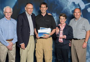
Recently, the centre was presented with the 2012 ESRI Inc. Special Achievement in GIS (SAG) Award at the company’s international conference in San Diego. The award is given to user sites around the world to recognize outstanding work with GIS technology.
Dal’s GISciences Centre was the only Canadian group recognized with the award this year, and the only library-based organization in the world. More than 100,000 organizations are eligible for the honour each year.
Dal’s centre represents the largest user community of GIS within higher education in Canada – meaning more GIS-related work across faculties and disciplines, and more students and faculty exposed to the role that GIS plays in teaching and research.
James credits his office’s success to the students and staff who work there, including its current contingent: Jennifer Strang, Ray Jahncke, Max Lapierre, Jennifer Charney and Jennifer Grek-Martin.
“I trusted my instincts to get the right people around me: staff, students, supporters, collaborators…I really believe in being a facilitator and a networker, bringing the right people into the room.”
Learn more: GISciences Centre website
