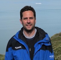
Dr. Claudio Aporta
Professor, Canadian Chair, Marine Environmental Protection

Dr. Claudio Aporta - BA, PhD (Univesity of Alberta)
Email: ca@wmu.se
Mailing Address:
- Indigenous Land Use
- Indigenous Geographic Knowledge
- Cartographic Representations
- Arctic Anthropology
- Inuit and Sea Ice
- Northwest Passage History
- Marine Spatial Planning
About
Claudio was born and raised in the province of Mendoza, Argentina – where he completed his BA in Communication at Universidad Nacional de Cuyo. He holds a Ph.D. in Anthropology from the University of Alberta. He was a Postdoctoral Fellow at Université Laval, and a faculty member in the Department of Sociology and Anthropology at Carleton University, before moving to Dalhousie in 2013. He held the Canada-US Fulbright Chair at the University of Washington in 2012. his research is at a crossroads between Anthropology and Geography.
Research Interests
Claudio has done ethnographic research in the Canadian Arctic since 1998. He has documented Inuit knowledge and use of marine and coastal areas in all regions of the Canadian Arctic. Claudio’s research has also focused on the geographic representation of indigenous environmental knowledge. His projects have been funded by Wenner-Gren, SSHRC, NSERC, National Geographic Society, Canada Foundation for Innovation, Levrhulme Trust, the Government of Nunavut, and a number of indigenous organizations. He is also a faculty member of the Geomatics and Cartographic Research Centre at Carleton University, and the current director of MAP VISLAB. Some outcomes of Claudio’s work include the co-creation of digital atlases (see http://paninuittrails.org/, and http://sikuatlas.ca/index.html, https://www.ntkp.ca/, https://www.anijaarniq.com/, http://pikialasorsuaq.org/en/Resources/Pikialasorsuaq-Atlas ).
His current interests are connected to co-management, sustainable communities, Marine Spatial Planning, indigenous and local coastal knowledge, and knowledge mobilization. His current projects include documenting Inuit mobility networks in Arctic Canada, exploring the impact of shipping in areas of significance to Inuit communities, and exploring the potential of geo-visualizations and marine spatial planning as processes that facilitate knowledge sharing and co-governance in cross-cultural contexts. In Atlantic Canada, he is working on documenting knowledge of benthic ecosystems in some Nova Scotia coastal communities, in the context of the BEcoME project.
Latest Professional Honours
2011-2012
Fulbright Visiting Research Chair in Canadian Studies (University of Washington, Seattle)
2011
CRASSH Visiting Fellowship, Centre for Research in the Arts, Social Sciences and Humanities, University of Cambridge, UK.
Claire Hall Visiting Scholar Fellowship, University of Cambridge, UK.
Research Achievement Award 2011-12, Carleton University
Refereed Publications
Books Edited
Governance of Arctir Shipping: Retuinking Risk, HUman Impacts and Regulation. Chircop, A., Goerlandt, F., Pelot, R and Aporta, C. (Ed.) 2020. Cham, Switerzland: Springer.
Knowing Our Ice, Documenting Inuit Sea Ice Knowledge and Use. Krupnik, I., Aporta, C., Gearheard, S., Laidler, G. J. and Kielsen-Holm, L. Siku:, Netherlands, Springer (501 pages) (2010).
Journals Edited
Inuit Geographies of Sea Ice. Aporta, C., Taylor, F., Laidler, G. Special issue of The Canadian Geographer, 55(1) (2011).
Chapters in Edited Books
Knowledge and Data: An Exploration of the Use of Inuit Knowledge in Decision Support Systems in Marine Management. Aporta, C., Bishop, B., Choi, O., Wang, W. In Governance of Arctic Shipping: Rethinking Risk, Human Impacts and Regulation. Cham, Switzerland: Springer. (2020)
Living, Travelling, Sharing: How the Land Permeates the Town through Stories. MacDonald, J. and Wachowich, N. (Eds) The Hand's Measure: Essays Honouring Leah Aksaajug Otak's Contribution to Arctic Science. pp 185-199. Nunavut Arctic College Media. pp. 185-199. (2018)
Markers in space and time: Reflections on the nature of place names as events in the Inuit approach to the territory. Whallon, Robert, and Lovis, William (eds) Marking the Land: Hunter-Gatherer Creation of Meaning within their Surroundings (Routledge), pp. 67-88 (2016)
The Power of Maps: ILUOP (1976) as a Landmark in Inuit Land Use Studies, in Krupnik, I. (editor) Early Inuit Studies: Themes and Transitions, 1850s-1980s (Smithsonian Institution Scholarly Press), pp. 354-373 (2016).
Aporta, C., Kritsch, I., Andre, A., Benson, K., Snowshoe, S., Firth, W., Carry, D., (2014): The Gwich'in Atlas: Place Names, Maps, and Narratives, in: Taylor, D.R.F., Lauriault, T.P. (Eds.), Developments in the Theory and Practice of Cybercartography. Elsevier Science, 229-244. (2014)
“From Inuit wayfinding to the Google World: Living within an ecology of technologies,” in Miggelbrink, J., Habeck, J., Mazzullo, N., and Koch, P. (eds) Nomadic and Indigenous Spaces: Productions and Cognitions. Ashgate, Farnham (2013).
The sea, the land, the coast and the winds: Understanding Inuit sea ice use in Context in Krupnik, I., Aporta, C., Gearheard, S., Laidler, G. J., and Kielsen-Holm, L. Siku: Knowing Our Ice, Documenting Inuit Sea Ice Knowledge and Use, Netherlands, Springer (pp. 165-182) (2010).
Life on the ice. In: Main Johnson, Leslie, and Hunn, E. (ed.) Landscape Ethnoecology: Concepts of Biotic and Physical Space, Berghahn Books, New York, pp. 175-199 (2010).
SIKU: International Polar Year, #166 (An Overview). Krupnik, I., Aporta, C. and Laidler, G. J. (2010) in Krupnik, I., Aporta, C., Gearheard, S., Laidler, G. and Kielsen-Holm, L. Siku: Knowing Our Ice, Documenting Inuit Sea Ice Knowledge and Use, Netherlands, Springer (pp1-29).
Mapping Inuit Sea Ice Knowledge, Use, and Change in Nunavut, Canada (Cape Dorset, Igloolik, Pangnirtung) Laidler, G. J., Elee, P., Ikummaq, T. Joamie, E. and Aporta, C. (2010), in Krupnik, I., Aporta, C., Gearheard, S., Laidler, G., and Kielsen-Holm, L. Siku: Knowing Our Ice, Documenting Inuit Sea Ice Knowledge and Use, Netherlands, Springer (pp. 47-82)
Articles in refereed journals
Picturing Pikialasorsuaq: Ethics & Effectiveness of Representing Inuit Knowledge in an Online Atlas. Tesar, C., Egede Dahl, P. & Aporta, C. 2019. The Journal of Ocean Technology 14 (1): 12-22 (2019).
Shipping corridors through the Inuit homeland. Aporta, C., Kane, S. and Chricop, A. Limn Journal 2018: 50-65 (2018).
Shifting perspectives on shifting ice: Documenting and representing Inuit use of the sea ice. The Canadian Geographer, 55(1): 6-19 (2011).
The Igliniit Project: Inuit hunters document life on the trail to map and monitor Arctic change. Gearheard, S., Aporta, C., Aipellee, G., and O’Keefe, K. ‘’ The Canadian Geographer, 55(1): 42-55 (2011).
The Trail as Home: Inuit and Their Pan-Arctic Network of Routes. Human Ecology April 2009: Volume 37: 131–146; DOI 10.1007/s10745-009-9213-x (2009).
From map to horizons; from trail to journey: The challenges of documenting Inuit geographic knowledge. Études Inuit Studies, Volume 29 nos 1-2 (2005): 221-23.
Satellite Culture: Global Positioning Systems, Inuit Wayfinding, and the Need for a New Account of Technology,” With Eric Higgs, Current Anthropology, Volume 46, Number 5, December 2005: 729-754
Routes, trails and tracks: trail-breaking among the Inuit of Igloolik,” Études Inuit Studies (vol. 28(2), December 2004): 9-38 (2004).
Using GPS mapping software to map Inuit place names and trails,” Arctic Vol. 56, No. 4: 321-327 (2003).
Life on the ice: Understanding the codes of a changing environment.” Polar Record 38 (207): 341-354 (2002).
